July 31 Nearing the end of our road trip

[Hooray! this morning we both tested Covid negative which made us a little silly with relief but still there was a faint shadow of concern lingering about what might happen over the next couple of days however .... ]

Loath to join the flow of tourist traffic along Hwy 1, the famous ‘Ring Road’, I found an alternative route through ‘farming’ country and lava flows, passed odd mounds which looked a little like pseudocraters. Before I go on I should explain pseudocraters because they are found in very few places worldwide - Iceland, Hawaii, one in the Azore islands (which formed along the same Mid Atlantic Ridge as Iceland) - and in the Athabasca Valles region of the planet Mars apparently. These rootless/ventless craters form when hot thin molten lava flows over a wetland or boggy areas. The hot lava boils the water of the wetlands and the steam pressure causes explosions, creating clusters of these pseudocraters.  We saw some near Myvatn. Now back to the road ....

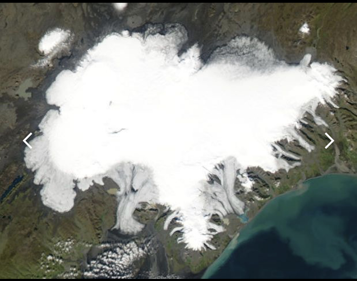
In the distance is Myrdalsjokull ice cap

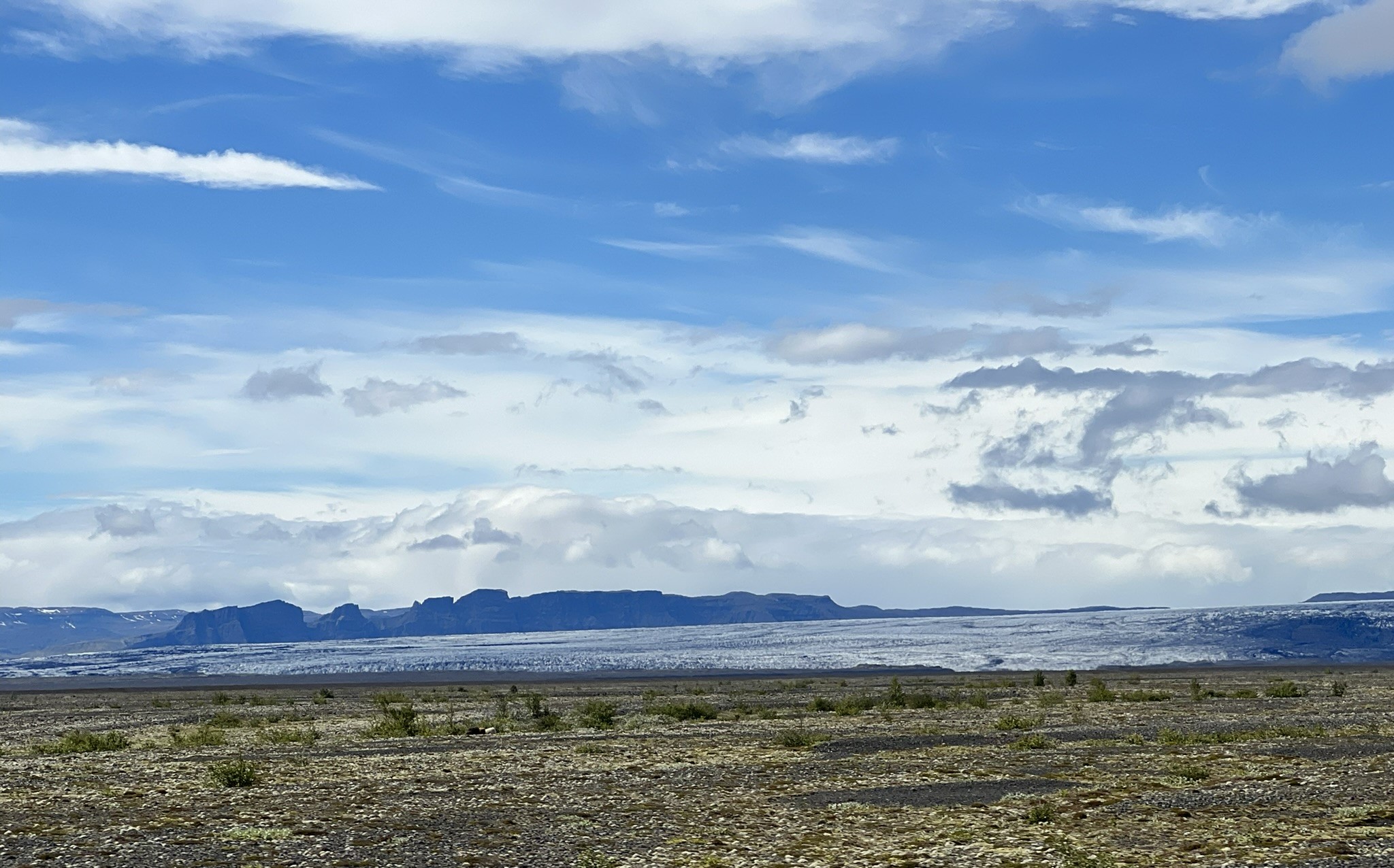
Glacial melt waters meander across this relatively flat area
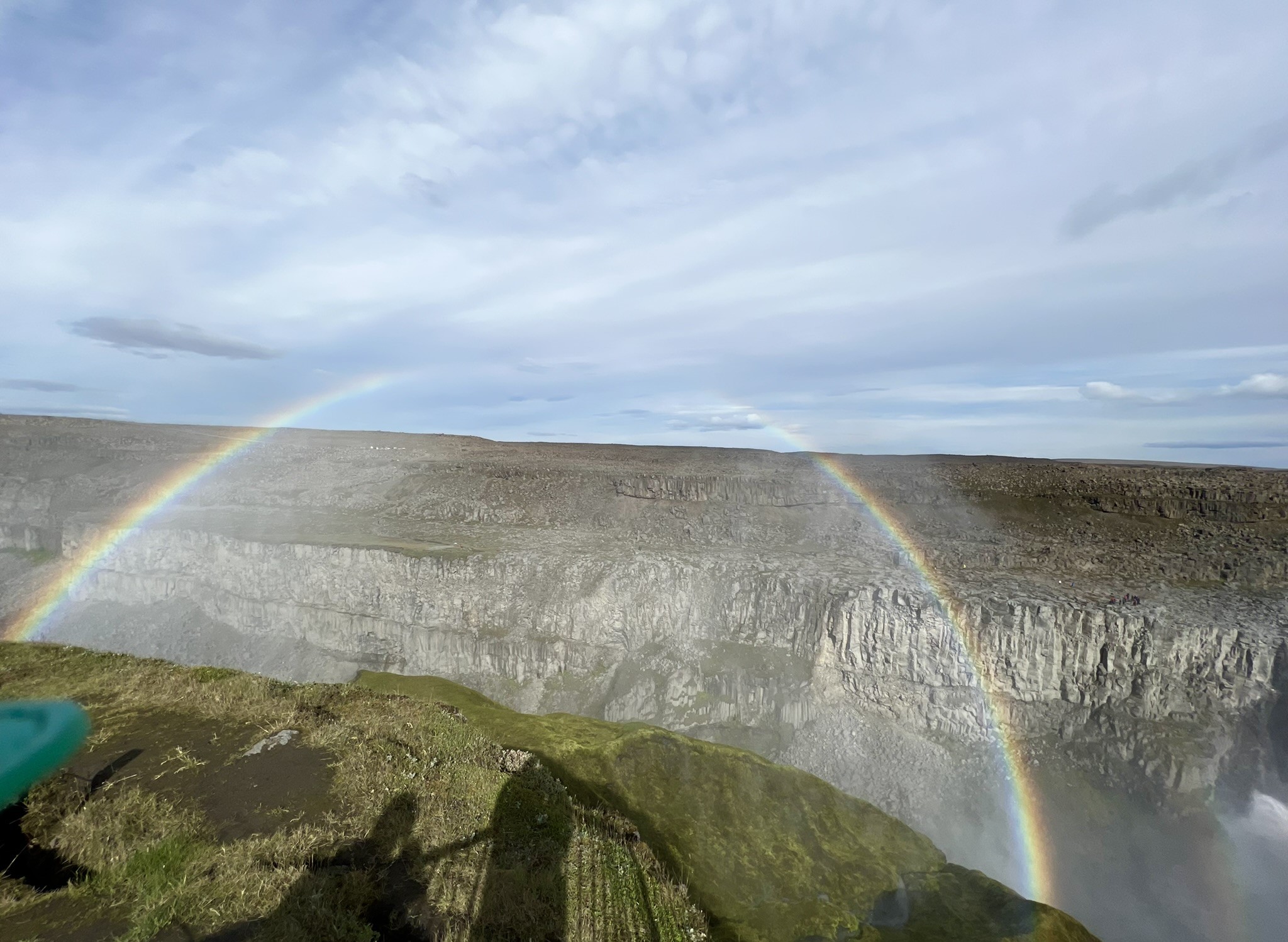
Lava fields all around us

It was quite delightful with no cars to worry about so we were able to drive as slowly and turn around as much as we chose - and unsurprisingly for us we did that many times! All the while we were heading closer to Mýrdalsjökull in the south of the Icelandic highlands. It is the country's fourth largest ice cap.

We ventured into that cave and found old whale bones
Along our westward route, a couple of coastal features attracted me. The first, a huge block/headland of green velvet-covered rock had us picking our way along a rough rutted road towards a wide expanse of black sand. Intriguing. Conscious of the time, however - and not to mention the ground was soft and promised bogs - we kept moving west until we reach the second location that interested me. A cluster of islands off a rocky headland, Reynisfjara - a protected area for birds. Being a holiday weekend, the area was teaming with people however .... 
Iceland has very few public toilets. These at Reynisfjara were 'Loos with a view' - $2 entry!
Stunning dark rocky shoreline clothed in green velvet
and hemmed in fine obsidian sand

These columns were created by the cooling of lava comprising mostly basalt
There are two startling focal points at Reynisfjara - one on either side of a large estuary. To the east are tall black phalanxes of ancient lava jutting ominously out of the sea and along the cliff face towering basalt columns rise into the sky; these were festooned with the adorable Atlantic puffins. In Icelandic legend, it was said that the Reynisdrangar (those 'sea stacks') are the remains of a battle between two local trolls and a three-masted ship. When daylight broke, the two trolls were turned to stone, and the ship was trapped with them for all eternity, forming a group of sea stacks which are now call the Reynisdrangar Columns. I love Icelandic sagas!  One which relates to the cave inside the towering basalt columns is the Seal Skin Sage; I hope you can read the saga in the photo. Briefly it is based on the belief that seals descended from humans and that once a year they will come on land and cast off their seal skin to dance and sing through the night. 

On the west side of the lagoon was a high jutting headland overlooking Dyrholaey which literally means 'the hill island with the door hole'; it is thought to have formed 80,000 years ago in a submarine eruption.  The islands are protected as bird sanctuaries. There were also other strange coastal rock formations, reminiscent of Victoria’s Twelve Apostles, rising out of wide stretches of fine black sand. It's quite stunning.  

Reynisfjara's long beach of black sand is supposedly the most famous beach on the South Coast of Iceland. The sand is black because it was formed from heavily eroded volcanic rocks which were black (or obsidian) having been formed from cooled lava which turns black as it cools and hardens.  The area is quite fascinating but the waters are treacherous and dotted with shipwrecks so rescue winches have been built atop these high cliffs. They have unpredictable waves they call sneaker waves which have drowned a few people; there were many warning signs along the beach.

Sneaker waves - I know what they mean.  R: traffic signs are cute. Smiley face and hearts if you're doing the right speed.
Then it was back on the road; this time we had to join the weekend traffic on the 'Ring Road'. The scenery nevertheless was picture postcard perfect and I happily snapped away as we whizzed by, one of the 'motorcade'.  I've included a few pix just for the sheer delight of sharing this beautiful island state: there are very few places you can pull off the road to take photos, or the like, so quality may be lacking. 


Eyjafjallajokull and Myrdalsjokull on the horizon in front of us.
Here we are approaching Skógafoss (foss is Icelandic for waterfall)
On this trip we have seen more waterfalls than ever before in the end however we had to ration ourselves if we were to ever get back to Reykjavik.  We decided to visit Skógafoss, on the Skógá river. One of Iceland's largest.  Skogafoss is unique because the waterfall comes directly from two glaciers, Eyjafjallajokull and Myrdalsjokull. It was wet, we were wet! Mist from the waterfall and rain and yet it was awash with visitors.  We opted against joining lots of other people who were climbing the staircase beside the falls for views over Iceland's South Coast (we were wet enough and lacked the energy). It was quite a stunner.
That's as close as we got to Skogafoss 
According to legend, the first Viking settler in the area, Thrasi Thorolfsson, buried a treasure in a cave behind the waterfall. The legend continues that locals found the chest years later, but were only able to grasp the ring on the side of the chest before it disappeared again. I can imagine Golum's chilly hand stretching out of the darkness; in fact Iceland is very much Hobbit-like.  
A day of driving past glaciers, waterfalls and lava fields

The road west into Reykjavik was almost bumper to bumper but we arrived mid afternoon and managed to find our way to our hotel - eventually. With a sense of relief we unpacked what we needed and relaxed ..... until the hotel gave an all mighty shudder! I rushed downstairs to reception to ask what was going on, whether that was an earthquake. "Indeed madam it was" the long suffered receptionist told me. "Not to worry" he said, "all the buildings are designed to withstand earthquakes, this is quite normal and a frequent occurrence. Welcome to Reykjavik!"  That turned out to be a 5.1M.  The building shook and shuddered for hours before settling to the occasional thump. Seems the earthquake activity stemmed from volcanic activity on Reykjanes peninsula - where, incidentally, Reykjavik is located and us, we were on the 33rd floor, yikes!  It may not seem a huge thing to others accustomed to earthquakes but to we Australians who live on relatively stable ground, it was 'an experience'. 

View from our 33rd floor window

Earthquakes aside, Aurora Expeditions required that we present negative Covid tests before boarding two days later so we set about trying to organise those for the following day. Turned out harder than we thought but to cut a long story short the wonderful Aurora agent, Anne, came to our rescue and we were set to have the tests the following day - then return our rental car. 

That night we had dinner in the beer garden surrounded by what looked like 100s of different brands of beer.  At around 3 am we were shocked awake by a 5.4M earthquake. Very disconcerting and of course sleep was almost impossible after that but we were comforted by the thought that we’d be heading out to sea very soon and away from this volatile region. 

Coloured dots and stars indicate seismic activity; blue circle is where we were less than 20Km away. 


July 30 Lava and glaciers

A wee portion of the mammoth Vatnajokull icecap
Over the past week, we’ve passed lava tumbled together in shelves, massed in solid walls, spewed out in crazy bumpy, lumpy fields and crumbling tongues stretching out into the sea - quite awesome. Mountain sides, fallen off eroded by time, wind, water and snow, collapsing in huge cones of deep dark loose scree like swirling Dervish skirts around their feet.  But today was about glaciers. This morning in the distance we could see the massive icecap of Vatnajokull from Hofn, where we’d stay overnight. The very idea of such a huge mass of ice was jaw dropping - 8000 km2! Throughout the day, we drove and snapped and oohed and aahed - it was staggering in its immensity. And we were to drive close to other icecaps that day.

Much of the day we drove the southern edge of this huge icecap 
Most of Iceland's icecaps are in the south.
Diamond Beach and the iceberg graveyard

We walked down to the famous black sands of Diamond Beach where chunks of ice, 'bergy bits', carved off the large Jökulsárlón glacier, one of the icy tongues extending from Vatnajokull, had become beached. There they sit glistening, sparkling and dripping, frigid and dazzling against their dark backdrop. Scrambling along the gushing river bank, where huge chunks of ice were being swept along and where birds were diving for fish thrown up by the gushing churning water, we climbed to see Jökulsárlón glacier lagoon where massive chunks of ice, calved off that massive glacier, share a communal graveyard. Apart from the hoards of tourists, we were watched by a few curious Harbour seals.  


This was a flight of Giant's stairs

Rather overwhelmed by it all and in order to escape the milling throng, we found a 'quiet' spot to have lunched beside a gushing, surging stream the colour and texture of which resembled café-latte. The water rushing seaward was ice melt from one of the many glaciers which extrude worm-like tubes of icy toothpaste from Vatnajokull, the origin of 30 odd glaciers. Incidentally there are a number of volcanoes under that icecap. Can you image what it would look like when one erupted? It is awesome as it is - there is no other word that I can think of. 

Stretching out to the sea from the base of those lofty mountains and glaciers is land scoured bare for miles by glaciers and lava flows. I imagine that once these glaciers may have covered this entire area. 

When we could drag our eyes from the road and snow capped mountains, the sky was gentle and restful.

Desolate now, this once must have been covered by glacial flows 

Many lava fields are being infiltrated by lichen
which slowly and imperceptibly breaks down the rock

Feeling rather exhausted with the excitement of it all, we collapsed into a delightful wooden cabin set beside a dreamy little lake at the Magma ‘hotel’. Our only company was a pair of loons and a wee herd of Icelandic ponies. We were wishing we could stay for a few days of silence, contemplation and rest, but a ship was awaiting us in just 2 days - so we just drank in as much as we could. 

That night we snuggled into this wee wooden grass-capped cabin

July 29 Eastern Iceland

Before launching into the rest of the day I want to mention breakfast - I know, food and flowers tend to dominate at times!  As we had come to expect, it was plentiful with lots of choices including some healthy supplements - cod liver oil, beetroot juice with fresh ginger, and some capsules which I think were Vitamin D. We had seen Cod liver oil offered elsewhere but the beetroot and ginger was a new delicious addition. However .... 

That creamy number in the right foreground is Chia - delicious

We were travelling in the eastern part of Iceland

Feeling thoroughly sated, we headed north towards Borgarfjordur through foggy mountains, rain, along steep sometimes precipitous roads with slippery scree sliding right down to the ocean; roads to this fishing village weren't built till 1950s. The bay at the end of that challenging drive was well worth it. Quite remote and totally delightful. 


Looks noxious here but the dangerous Njardvik Screes are subject to avalanches
Borgarfjordur 
Linderbakki, the red house, was build around 1900 and is typical of the old houses 

After a very short visit we were retracing our steps south because we were due in Hofn that night, over 400 km south. It felt like I was dodging windscreen wipers all afternoon trying to take pix as we drove under lowering skies. It was a brooding moody scene broken here and there with light skies but enjoyable for all that.  Along the road we had to slow to pass a small herd of Iceland ponies. They seemed unconcerned about sharing the road with cars. 


A wee coffee shop


Hard volcanic rocks poked up through the scree.
The beautiful Whooper swans flocked to protected bays

We made it to Hofn with time to spare and decided to 'stayed in' and dined on our plate de tour - this time noodles, overlooking a pretty harbour and under the watchful gaze of the massive Vatnajokull ('jokull' meaning glacier or ice cap).  As marvellous as it has been I think we are starting to feel the strain of being on the road for over a week with little time to smell the roses with the added concern about our Covid status and what they might mean for our expedition 3-4 days away. We took it easy that night.

Hofn, a fishing village, gives views out towards the huge glacial Vatnajökull 


July 28 Waterfalls and canyons

This is a land of oohs and aahs!

We would have liked to spend more time around Myvatn but there were still places we wanted to see. So we travelled further south along the Jokulsargljufur Canyon which cradles the river Jokulsa. This is a glacial river originating in that massive icecap, Vatnajokull, in the south. It cuts through old lava fields and is quite breathtaking. The canyon has been shaped not only by water but by volcanic activity - about 8-9000 years ago two volcanic fissures erupted in this area. The craters and lava formations in the canyon have been further shaped by water - it is a powerful force. Iceland is on the junction of the Eurasian and Nth American tectonic plates so it’s a very dynamic region and most unstable (see post 'Iceland an alluring place' for maps 21 July 2022). 

Extensive alluvial plains split be a great fissure 

Panoramic view of Hagragilsfoss 

Approaching Dettifoss. The mist from the Falls is just visible.
Flowers tucked in among the rocks: Bladder campions

Along the canyon, we stopped firstly at Hagragilsfoss and then at Dettifoss; the latter is the most powerful waterfall in Europe. It was a long day of walking, we covered over 11km. A number of the areas we have visited, mostly on the tourist route areas, seem to be in the process of being developed for tourism. The walks to view these falls were long and very rough: Dettifoss was about 2 km each way from the car park, but the view was worth the walk. We watched as great clouds of spray and mist from the thundering falls created shimmer perfect rainbows in the sun. 


Hostile rocky terrain surrounds this beauty.  

In places a second rainbow could be seen.

Absolutely stunning! Which end was the pot of gold?

Magnificent, spell binding in its magnitude and power, the canyon through which this river rushes is huge and the deep. At times the river floods out over the lava plains creating a lake many kilometres wide; the water is all snow and ice melt. It is most impressive. 


Crossing the roaring Jokulsa River

Iceland wraps you around with beauty!

Striking patches of Arctic lupins lined the road

We continued eastward and made it to Egilsstadir that evening; we've been fascinated by the names of the places we've visited; this one simply means the place of Egill who was the first known farmer to farm this place. The town is located on a long lake and is locally known as the ‘reindeer town’ because these lovely animals are often seen around here.  After living quite frugally for a week we dined out that night on local fish - Cod and Ling. Both were delicious. We would have loved to try the reindeer but at around $100 per serve we opted against that experience!  

Crossing the long lake into Egilsstadir

L: Ling with spring onions, cauliflower, lime, coconut veloute. R: Cod with broccilini, lemon., grapes, smoked beurre blanc and pickled apple. 

Moving into 2023

 Tomorrow we start our long haul journey to South America - Melbourne-Auckland-Santiago-Buenos Aires. Exhausting but we arrived with our lug...